Singapore Hosts First International Seminar on United Nations Global Geospatial Information Management
The Maritime and Port Authority of Singapore (MPA) is hosting the first International Seminar on United Nations Global Geospatial Information Management from 10 to 12 May 2022. Themed ‘Effective and Integrated Marine Geospatial Information Management’, this hybrid seminar is jointly organised by MPA, the United Nations Global Geospatial Information Management Section, Statistics Division, Department of Economic and Social Affairs, the United Nations Working Group on Marine Geospatial Information, the Marine Spatial Data Infrastructure Working Group of the International Hydrographic Organization (IHO), and the Marine Domain Working Group of the Open Geospatial Consortium (OGC).

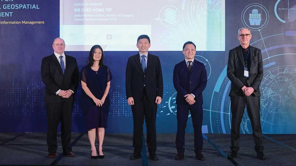
From left: Deputy National Hydrographer, Co-Chair UN-GGIM Marine Geospatial Information Working Group, UN-GGIM Americas Vice President, IHO IRCC Vice-Chair, IHO WEND WG Chair, NOAA, Dr John Nyberg; MPA Chief Executive, Ms Quah Ley Hoon; Senior Minister of State for Transport, Mr Chee Hong Tat; Singapore Land Authority, Mr Colin Low; Open Geospatial Consortium Senior Director, Mr Trevor Taylor
Leading international experts from academic and research institutions in the field of marine geospatial information shared their expertise on strategies to address key global issues such as climate change, disaster risk management, emergency response, as well as environmental management and protection. The plenary sessions will cover topics including effective governance, policy and legal frameworks, financing, data, innovation, and standards for integrated marine geospatial information management.
The International Seminar is also held alongside the Third Expert Meeting of the United Nations Working Group on Marine Geospatial Information, the 13th meeting of the Working Group on Marine Spatial Data Infrastructure of the International Hydrographic Organization, and the 2022 meeting of the Marine Domain Working Group of the Open Geospatial Consortium, from 9 to 13 May 2022.
Senior Minister of State for Transport, Mr Chee Hong Tat, was the Guest of Honour at the opening ceremony of the International Seminar today. “Having high-quality land-sea navigational and seabed data allows us to plan and make policy decisions more effectively, so that we can achieve better outcomes such as more efficient transport routes, reduced fuel consumption and safer navigation. It also enables stronger partnerships and opens new possibilities,” said Mr Chee.
GeoSpace-Sea web portal to be made accessible to the public
A web portal named GeoSpace-Sea provides comprehensive and consolidated geospatial information which is used for various applications including port, marine and coastal planning, and environmental management. The web portal allows users to securely upload and download data, and will facilitate collaboration among government, industry and academia in areas such as marine science research and development (R&D), marine conservation and climate change adaptation.
GeoSpace-Sea has also supported national sustainability initiatives such as monitoring and understanding the impact of climate change. The National Sea Level Programme, coordinated by the Centre for Climate Research Singapore under the National Environment Agency, aims to deepen understanding of how rising sea levels could affect Singapore; and the Coastal-Inland Flood Model, currently being developed by Singapore and aims to enable holistic flood risk assessment and aid in the planning of coastal protection measures by simulating the combined effects of extreme sea levels and inland flooding caused by intense rainfall.
Partnerships to drive innovation and collaboration
In October 2021, Singapore launched a partnership initiative to harness and develop emerging technologies in the hydrographic domain that support safe maritime navigation and protection of the marine environment. In addition, measures are afoot to contribute to the work needed for the establishment of MASS navigation data standards, including facilitating MASS test bedding in Singapore port waters.
In efforts to drive innovation, Singapore allows for three progressive types of use-case testing and fine-tuning namely – digital modelling, controlled environment testing using TCOMS Deepwater Ocean Basin research facility, and field test-bedding in Singapore’s waters. This collaborative development will pave the way for safer and more efficient operations of future maritime and ocean systems, harnessing synergies across the government research and industry sectors.
 Skip to content


